As I set off from the car park on the ridge high above Tyneham village, the elderly ladies in the car next to me wound down the window of their car and smiled at me. 'Oh the joys of a British summer!' exclaimed one of them, beaming at me. 'Yes indeed' I replied enthusiastically ' the view from up here really is fantastic' It was wet, windy and you couldn't see any further than the perimeter of the car park. I didn't care. The family were happily looking at monkeys and I had the opportunity of walking the army ranges at Lulworth. I didn't mind whether it was raining or not. Striding along the ridge towards Flowers Barrow the mist was thick, and all the gorse bushes were covered in countless droplets of water. The great fortifications of Flowers Barrow itself suddenly appeared out of the cloud, but as I took the steep descent into Warbarrow bay, I found myself dropping below the cloud and the familiar sight of Warbarrow Tout came into view.
A family party were struggling up the incredibly steep and slippery slope towards me. 'Its much easier going down' I called out heartily, moments before spectacularly losing my footing and sliding past two startled looking children.
 Looking back up the slope, Flowers Barrow was hardly visible in the cloud but the great chalk cliffs stretching round to Arish Mell and Bindon hill looked majestic. Reaching the beach at Worbarrow bay I found that I had it pretty much to myself and so decided to have my lunch looking at the sea and cliffs. I couldn't help remembering swimming there one hot summers day, and having to push away the occasional jellyfish.
 Lunch complete, I pushed inland to Tyneham village. Taken over by the army in 1943, a visit to the village is a powerful and moving experience. It is a lost place, of roofless shells of buildings and overgrown gardens. In each house there is a board telling you who last lived there, often with a photograph of the building as it it had been. Never allowed to return to their homes, the people of Tyneham were truly wronged, but had the army not taken over this coastline it would have been lost in other ways.
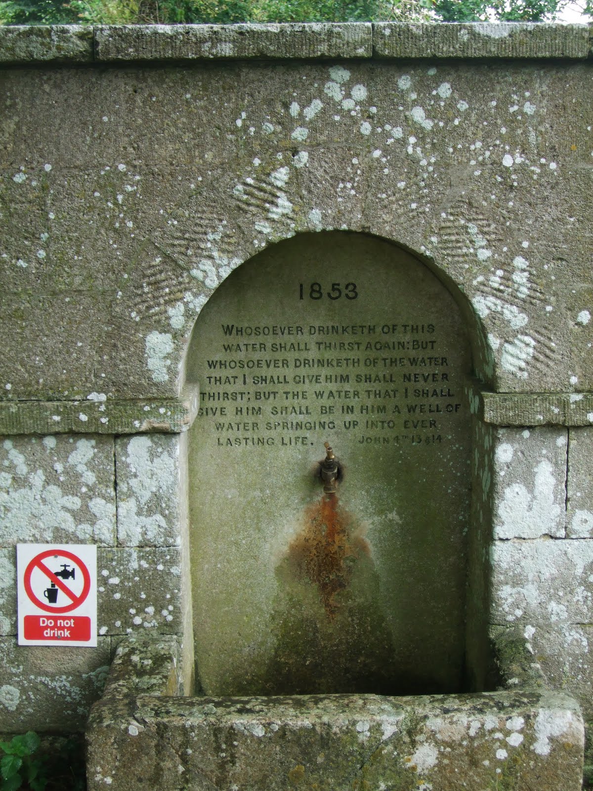 This drinking fountain is set into the wall of the churchyard at Tyneham. Scripture and modern health and safety concerns do not sit comfortably together.Click on the picture to enlarge the text.
 One of my favorite buildings in Tyneham is the Rectory. The top story has been removed but there are some evocative remains to be seen, such as as the bread oven, the old copper and the fire place.
 Here is the front door of the rectory. The circular mark with the square hole in the center shows where the bell push once was. If you enlarge the picture below you can just see it.
 Climbing up out of Tyneham I stopped and looked back at the site of the village. The roof of the restored church is just visible. The ridge on the skyline is Gad Cliff which drops down steeply to the see below. The marker posts in the picture mark the limit of the safe area. Beyond these posts unexploded shells can be found.
 I noticed these links from a tank track. They must have been there some time as a tree has grown up through them.
 Clear of mist, the ridge down which I had started my walk now offered magnificent views to the north, over the firing ranges towards Bovingdon. I could here the low rumble of tank engines and an occasional burst of gunfire.
 As I reached the car, my final view was of the Tyneham valley down to Worbarrow Bay with Portland somewhere in the distance.